
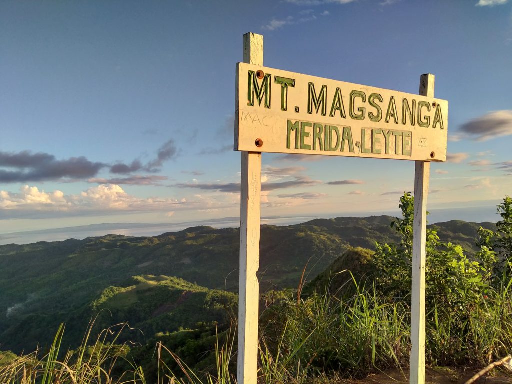
Standing at 655 meters above sea level (MASL). Mt. Magsanga is one of Isabel, Leyte’s beautiful natural wonder, attracting hikers both local and from around the country.
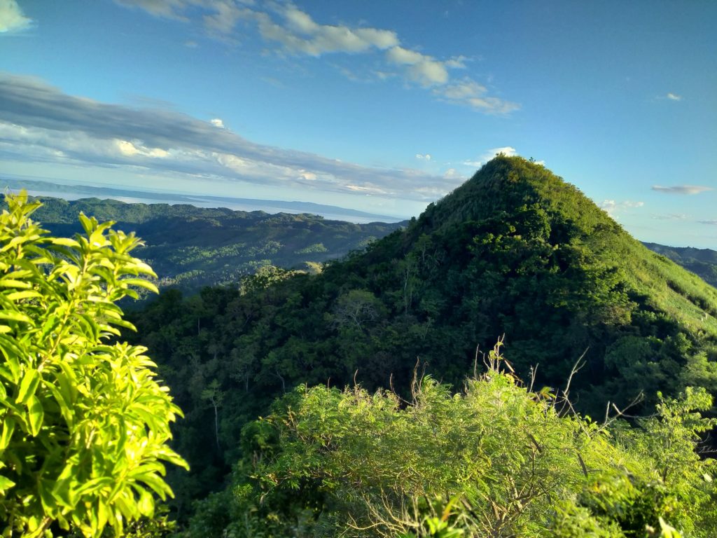
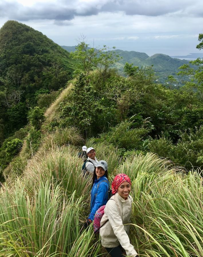
Interestingly, the peak got its name from the local word “sanga”, which means “to branch out”, as the mountain evidently has two peaks. The higher peak or “peak 1” is the more popular one among trek enthusiasts though a handful still visit the other peak or “peak 2”.
A little bit of trivia: Mt. Magsanga is one of the battlefields between American and Japanese forces back in World War II. Various remnants were found indicating that the area was once a Japanese army camp site as well.
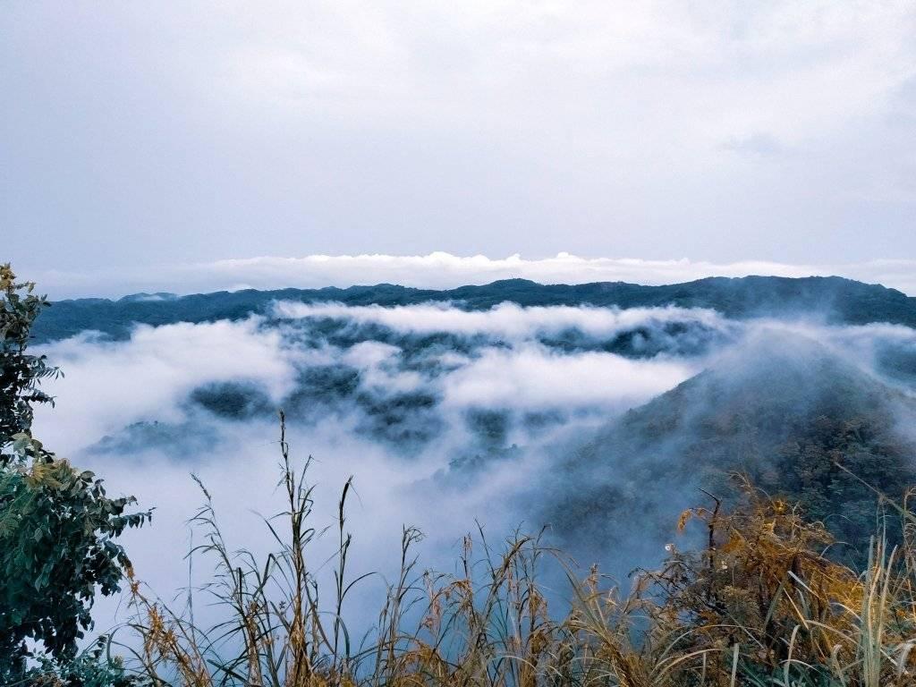
Though Mt. Magsanga is relatively shorter than other famous peaks in the Philippines, it is a wonder on its own, especially because of the magnificent view it offers during sunsets. One of the beautiful sightings while at the peak is the Ormoc bay, where its crystal-clear waters is reflecting during an epic sunset. Not to mention, along the hike, various critters, especially carabaos can be sighted.
CLIMBING MT. MAGSANGA
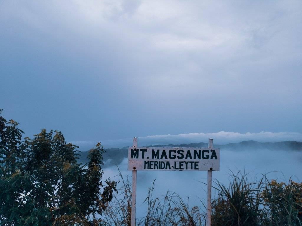
Before anything else, it is important to be reminded that there are three entry and exit points in reaching the peak: Brgy. Mahayahay and Brgy. San Jose both in Merida and Brgy. Cangag in the town of Isabel. Most local guides would recommend the Brgy. Cangag entry point since it has an easier trail going to the campsite.
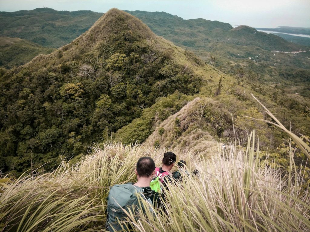
Most hardcore trekkers would rate the trail of this peak 5 out of 10 and is recommended for beginners. The trail is relatively easy and most of the time, the weather conditions is normal. Once in the campsite, be reminded that the maximum people catered at a time is around 30, so be sure to plan ahead.
Reaching the summit of Mt. Magsanga from the campsite can take up to 20 minutes and is considered the difficult part of the trail. The trail upwards is tricky, can be narrow and you only have sharp cogon grasses to hold onto while hiking.
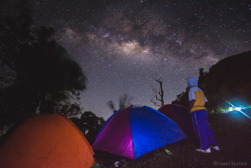
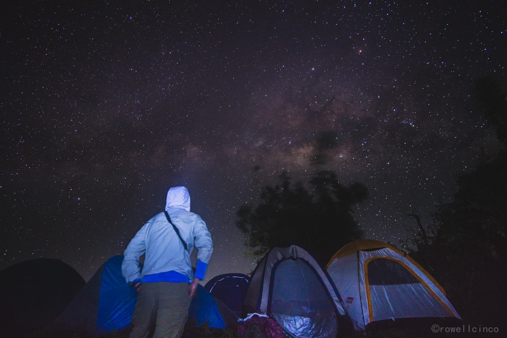
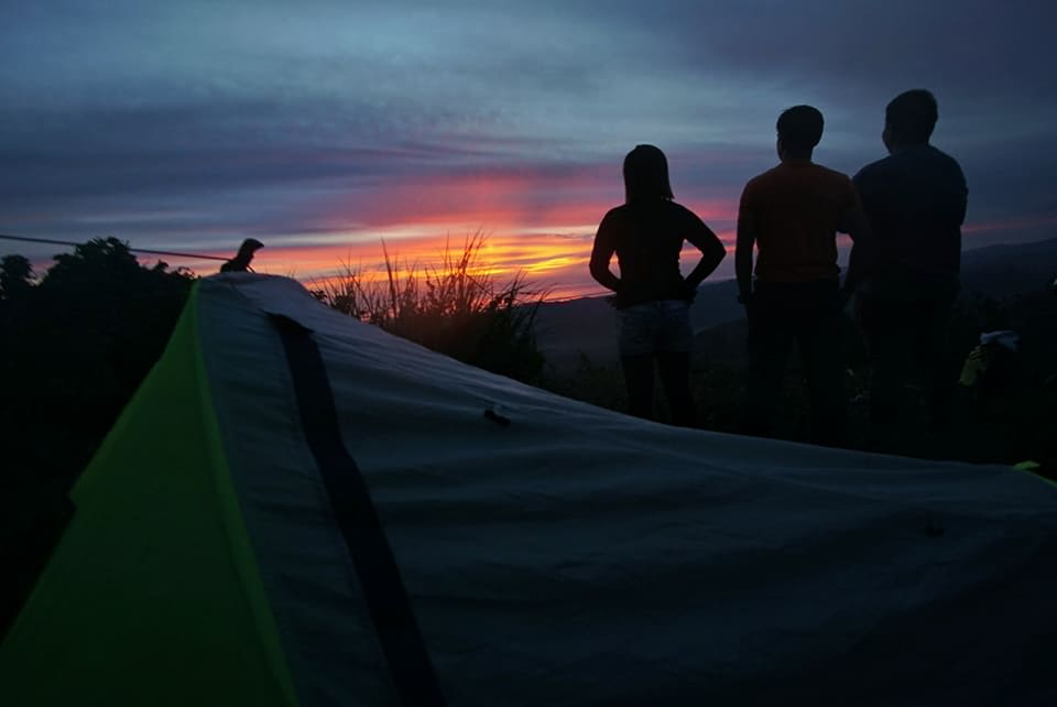
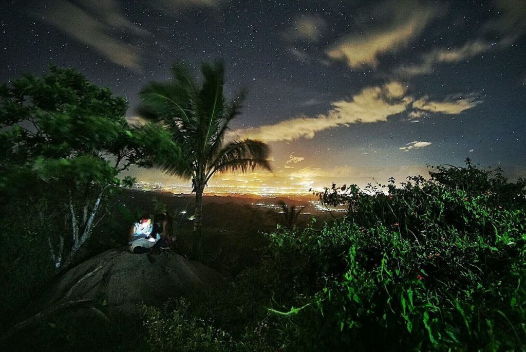
Once at the summit, a 360 view of the neighboring towns such as Palompon and Matag-ob. And like most mountain climbing activities, setting up tents or hammocks at the peak is allowed for those who want to stay overnight. From there, the view of the vast stars is mesmerizing.
HOW TO GET THERE
Exact Location: Brgy. Puting Bato, Isabel, Leyte
BY COMMUTE: Ormoc City can be accessed via plane, ferry, or bus. If travelling from Cebu, one can either take the Supercat fastcraft (Pier 4), which is a two-hour boat ride. There are also standard vessels that take about 5 hours to reach Ormoc City from Cebu. Once in Ormoc City, the most common modes of transportation are jeepneys and tricycles. You can rent a tricycle to take you to Isabel. Leyte, specifically in Brgy. Cangag if you choose this as your entry and exit point towards Mt. Magsanga.
BY CAR: Navigate with Waze or Google Maps and set your destination to “Mt. Magsanga” in Isabel, Leyte. Ask around the locals for more information on how to exactly get at the foot of the peaks or their entry points.
Comments are closed.