
The only meltdown you’ll want to hike right into.
The Margaja Valley stands as one of the most unique geological formations in the Visayas, which has a massive collapsed caldera on the high slopes of Mt. Kanlaon. This volcanic bowl attracts mountaineers, geology enthusiasts, and adventure seekers who are drawn to this unique landscape and raw natural beauty that can be appreciated. The valley forms part of Mt. Kanlaon Natural Park, which is a protected area spanning the Negros province, with access points.
Although the place is accessible year-round, the ideal visiting window is between December and May, when the trails are at their driest and volcanic activity is typically monitored at safer levels to ensure the safety of those trekking and embarking on this adventure.
Rimpossible Missions
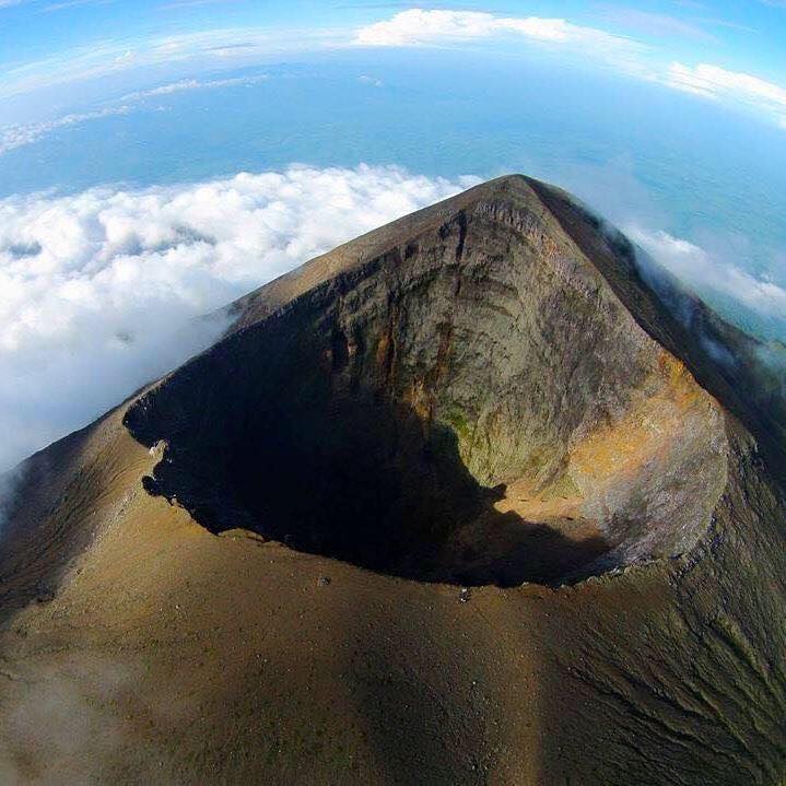
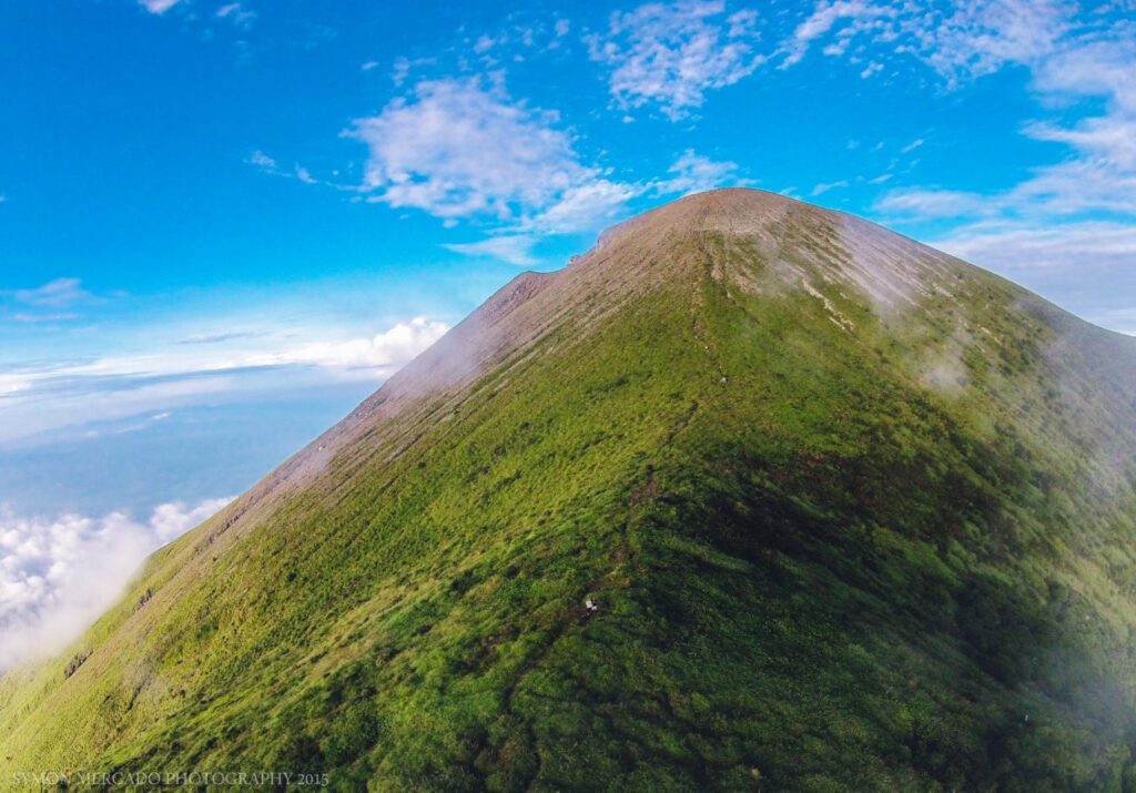
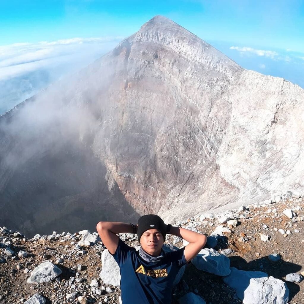
Reaching Margaja Valley requires crossing either the Wasay or Mananawin trail, as both wind through the forests before going through the caldera’s rim. The moment that the hikers crest Makawiwili Peak, the valley reveals itself as a wall plunging 335 meters down. The valley’s southern half transforms into a seasonal lake, while the drier periods expose lush grasslands during the dry season.
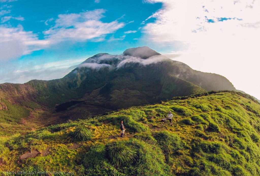
The surrounding landscape of the place showcases the volcanic personality of Mt. Kanlaon, while the views tempt closer inspection. However, caution and risk awareness are essential, as some rim trails narrow dangerously.
Nature Goes Boom
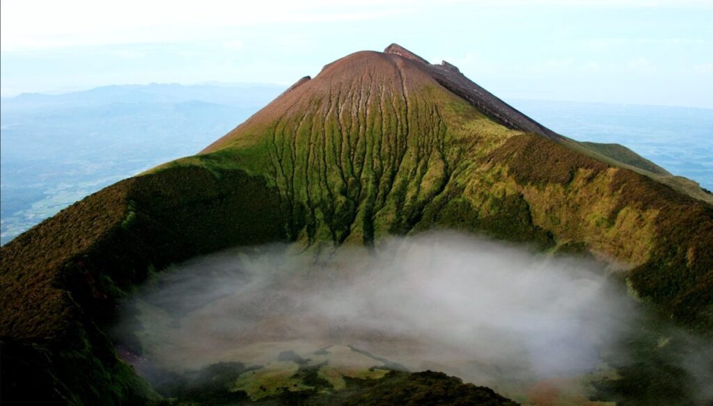
Designated as a Natural Park in 1934, Mt. Kanlaon dominates as the Visayas’ highest peak at 2,465 meters and one of the Philippines’ most active volcanoes, with over 40 recorded eruptions since 1819. Margaja Valley itself was born from volcanic collapse, its steep walls testifying to the mountain’s explosive history.
The park shelters different remarkable biodiversity, which includes endangered species like the Visayan tarictic hornbill and the Philippine spotted deer, growing within the forests that cloak the mountain’s slopes. This ecological significance, combined with its geological drama, makes Margaja Valley a living classroom for both volcanology and conservation.
Lake It or Leave It
The valley undergoes dramatic seasonal transformations. Monsoon rains from July to November can flood the basin with up to one meter of water, creating a temporary alpine lake that gradually recedes into emerald grasslands by summer. Park management has improved safety in recent years by rerouting some trails away from precarious edges while maintaining breathtaking viewpoints.
There are strict regulations that limit daily visitors, with mandatory permits and designated camping areas like the Margaja campsite along the rim. For those who have secure access, there are rewards waiting and in the nights under star-filled skies, mornings watching clouds spill over the caldera edge, and the humbling awareness of standing within an active volcanic landscape.
How To Get There
Exact Location: San Carlos City, Negros Occidental
- By Car: Travel via the Negros Occidental Eco‑Tourism Highway (N69) from Bacolod to Murcia, then onward to the chosen jump-off barangay, such as Wasay (Murcia) or Guintubdan (La Carlota/Canlaon). Roads are paved, but access past trailheads may require 4×4 or high‑clearance vehicles. You can use apps like Waze and Google Maps for a more accurate location.
- By Commute: Take a bus from Bacolod to Murcia or La Carlota, then hire a tricycle or van to your trailhead. From Canlaon City, short rides deliver trekkers to Guintubdan. Onsite trekking from the trailhead to Margaha Valley takes 4–7 hours, depending on the trail and pace.
The place offers more than just a view but it also gives a real encounter with the earth’s power. Visitors don’t just see nature, they stand in the middle of an active volcanic system that’s still shaping the land. Margaja Valley’s changing seasons, from flooded to dry, remind us of nature’s rhythm and our small place within it.
Comments are closed.