
Want to know what it feels like to trek in an active volcano’s crater? Keep on reading
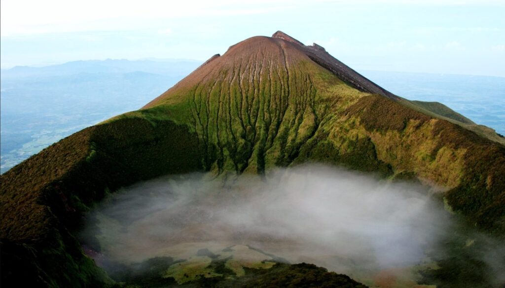
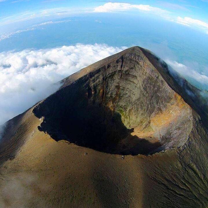
Located on Negros Island and straddling the provinces of Negros Occidental and Negros Oriental, Mt. Kanlaon rises to 2,435 meters above sea level, making it the highest peak in the Visayas. Mount Kanlaon is an active stratovolcano with a massive crater and geothermal features, the mountain is also a natural park that houses endangered species and vibrant greenery ecosystems.
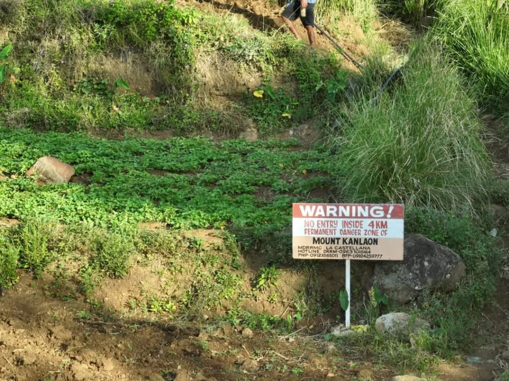
Warning Up Ahead!
While the mountain itself boasts a gorgeous journey, it is best to remember that it is an active volcano. A published report from PHIVOLCS showed an alert Level 3 (magmatic unrest) prevails over Kanlaon, which means that the volcano is in a state of magmatic unrest, with currently increased chances of short-lived moderately explosive eruptions that could generate life-threatening volcanic hazards. As of July 2025, all trekking and entry into the crater lake and summit zone are strictly prohibited under PHIVOLCS Alert Level 3. The entire 6-kilometer Extended Danger Zone (EDZ) is off-limits to recreational visitors due to the risk of explosive eruptions, pyroclastic flows, and ashfall.
Once PHIVOLCS downgrades the alert level and the Mt. Kanlaon Natural Park reopens for trekking, here’s what future adventurers can look forward to:
Trekking to the Crater Lake
The trip to Mt. Kanlaon’s crater lake is a multi-day adventure that combines physical hardship with natural magnificence. The trek typically spans 2-3 days, depending on your chosen trail and pace. It’s rated 7/10 in difficulty, so it’s best suited for experienced avid hikers.
Common Routes
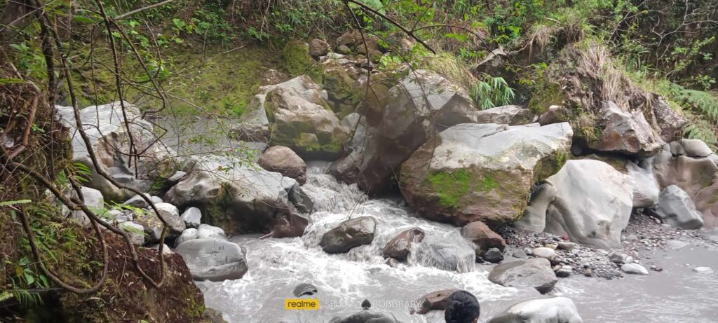
Some start their hike at Mapot-Masulog Trail in Canlaon City, and pass through Sudlon Falls and Makawiwili Peak before reaching the crater and Margaja Valley. While other hikers start at Guintubdan Trail where it is known for its mossy forests and biodiversity. The longest among the common routes would be the Wasay trail as it is the most forested route, often used for traverses.
Campsites
Makawiwili Peak offers panoramic views and a good first night stop when trekking to the crater lake. The next one would be Margaja Valley where it is a former crater that becomes a lake during the rainy season which is ideal for your second night.
Preparations
Always remember to wear proper trekking shoes, waterproof jacket, tent, sleeping bag and headlamps. It is also essential to bring 2-3 liters of water, trail food, first aid kit, and navigation tools. Before you trek, remember to get a guide as it is a requirement from the DENR and costs around Php 500 a day.
Things to Remember
Mt. Kanlaon’s most recent eruptions occurred in December 2024, April, and May 2025, with ash plumes reaching up to 4,000 meters and pyroclastic flows prompting evacuations in nearby towns like La Castellana and Canlaon City, indicating that it is still active. In order to safeguard against potentially fatal volcanic hazards such pyroclastic flows, ashfall, and unexpected eruptions, the region around the summit is now designated as a 6-kilometer Extended Danger Zone (EDZ). The no-entry zone is enforced by PHIVOLCS and the Regional Task Force Kanlaon, with support from local DRRM units.
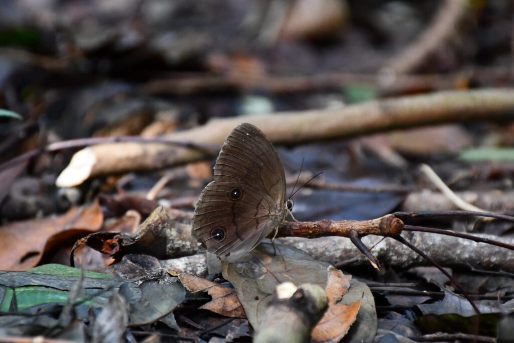
The Biodiversity and Natural Riches
As you ascend, your surroundings change radically. Lower slopes are covered with montane forest, which progressively gives place to thick, mossy cloud forest with unique species. Kanlaon is home to the elusive Visayan warty pig, Philippine hornbills, forest frogs, and an abundance of orchids that cling to trees like botanical jewelry. The ground beneath your feet vibrates with geothermal activity, with hot springs and fumaroles indicating the volcano’s pulsating heart.
How to get there
Exact Location: Sitio Mapot, Brgy. Maiba, Canlaon City, Negros Oriental (Jump off start of the trek)
- By Commute: From Bacolod, ride a Ceres bus to Canlaon. From Canlaon proper, take a habal-habal or jeepney to Sitio Mapot, Brgy. Maiba. This is where you’ll register and begin the trek toward Sudlon Waterfalls and Pagatpat Ridge
- By Car: Drive south via Bacolod South Road to San Carlos–Canlaon Road. Continue to Canlaon City proper, then follow signs to Sitio Mapot, Brgy. Maiba Road conditions: Mostly paved, but expect narrow, winding sections near the uplands
Comments are closed.