
Five stunning mountains in the Visayas offer exciting adventures and breathtaking views for nature lovers and hikers.
The Visayas region has some of the most breathtaking mountains, offering unique adventures for adventurers and stunning landscapes for enthusiasts. These peaks challenge hikers with their rugged terrain while rewarding them with panoramic views and a rich environment. Whether you seek a sea of clouds, high point views, and volcanic craters, the five highest peaks in Visayas can make the journey memorable for outdoor goers.
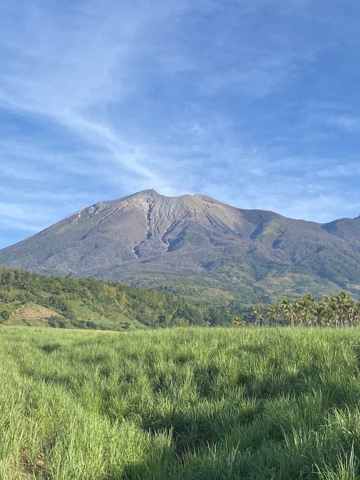
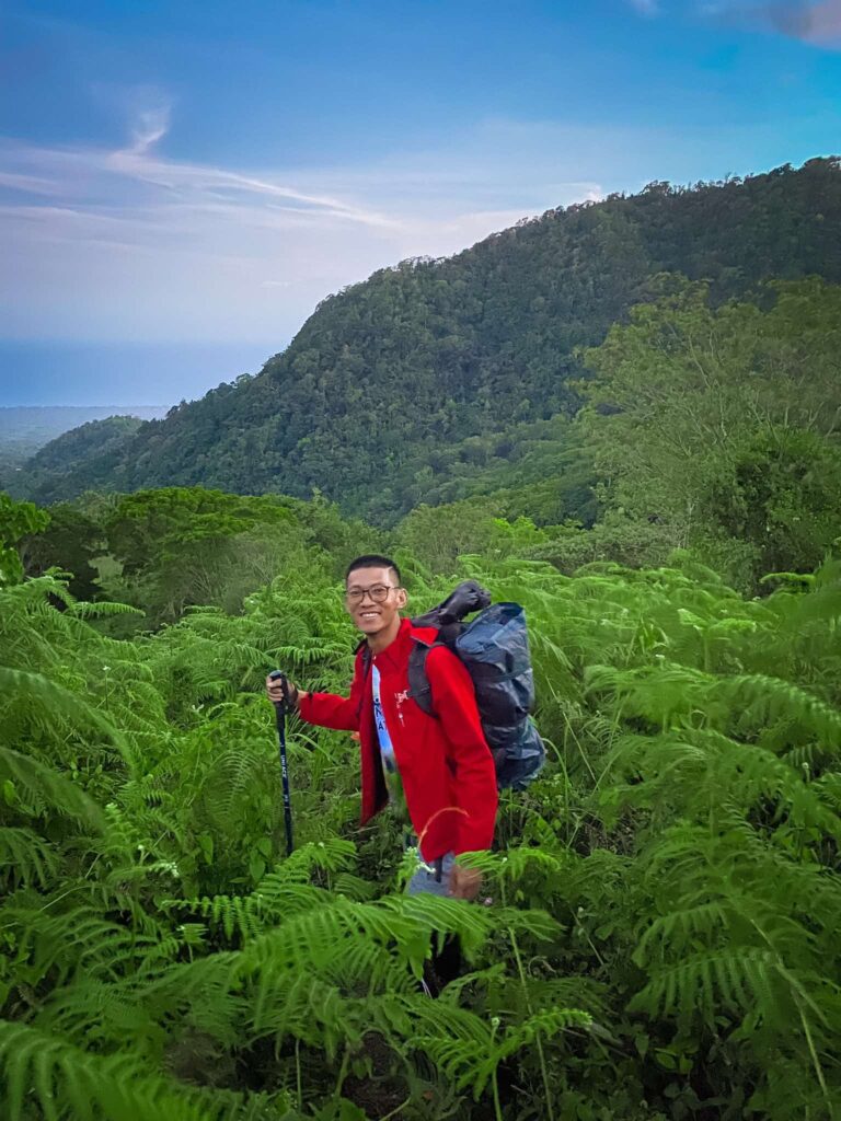
Mount Kanlaon (2435 MASL)
Located on the island of Negros, Mount Kanlaon is the highest peak in the Visayas region and one of the most active volcanoes in the Philippines. It’s full of lush forest and nearly perfectly conical, making it a favorite among visitors and hikers. While the steaming craters serve as a reminder of its volcanic nature, the mountain is part of Mount Kanlaon Natural Park. It has been protected in an area with diverse and varied wildlife and scenery, making it a must-see destination. Climbing Mount Kanlaon requires careful planning due to its volcanic activity, with a popular trail that leads to the summit crater. Along the way, hikers may encounter mossy forests, sulfuric vents, and panoramic view of the negros ans its neighboring island. Treks are often regulated, as it is essential to secure permits and check every volcanic alert before you start your journey.
How To Get There?
Exact Location: San Carlos City, Negros Occidental
- By Car: From San Carlos City proper, drive toward Barangay Quezon or Barangay Wasay, depending on your chosen trail. Follow the local road signs to Mount Kanlaon Natural Park. Travel time is around 30 to 45 minutes, depending on road conditions. You can use navigation apps like Google Maps or Waze for more straightforward Route guidance.
- By Commute: From San Carlos City, ride a habal-habal (motorcycle taxi) or tricycle going to the trailhead in Barangay Quezon or Wasay. Ensure you arrange your trip in advance and confirm availability with the local tourism office or the DENR.
Mount Madja-as (2117 MASL)
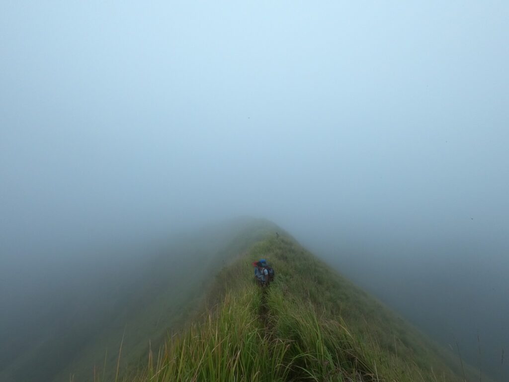
Hidden amidst the mist, Mount Madjaas in Atiques is the second-highest mountain in the Visayas, also known as the Mystical Domain of the Visayan Gods. The place holds a deep cultural significance for the indigenous communities who believe it to be a sacred dwelling place for ancient deities. The dense forest and challenging terrain of the mountain make it an excellent trek for adventurers. The journey to Madjaas is not for beginners, as it involves stepping through ridges, crossing rivers, and navigating thick jungle, often taking 3-4 days. Hikers at the summit’s top will be rewarded with a stunning view, where they can take photos of their adventure memories.
How To Get There?
Exact Location: Culasi, Antique, Visayan Islands, Philippines
- By Car: From Iloilo City (the nearest major city), take the Iloilo-Antique Road via Route 63 heading west toward San Jose de Buenavista. Continue driving for approximately 3-4 hours until you reach Culasi, Antique. Once in Culasi, follow the signs to Brgy: Flores, the jump-off point for Mount Madjaas. The final approach involves rough terrain, so a 4-wheel drive vehicle is recommended. For precise navigation, use Google Maps or Waze and search for “Mount Madjaas Jump-off Point” or “Brgy. Flores, Culasi.” Local guides are essential for the last stretch, as the terrain becomes challenging.
- By Commute: Starting from Iloilo City, take a Ceres Bus or van bound for San Jose de Buenavista (Antique’s capital) at the Iloilo Terminal. Travel time is around 3 hours. From San Jose, transfer to another bus or jeepney heading to Culasi (1.5-2 hours). Upon arrival in Culasi, hire a habal-habal (motorcycle taxi) to Brgy. Flores, where the trek begins. Arrange for a local guide in advance, as the trail requires expertise in navigating river crossings and dense forests.
Mount Nangtud (2073 MASL)
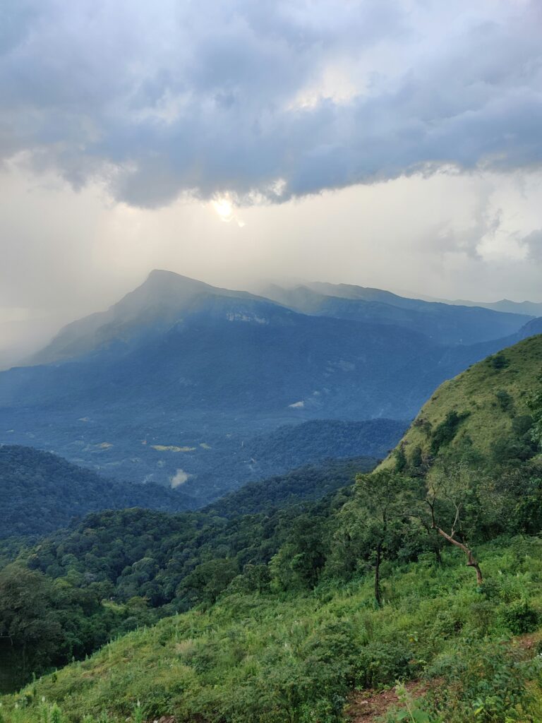
Found in Antique, Mount Nangtud is the third highest mountain in the Visayas and also one of the challenging treks and climbs in the region. According to the local dialect, the mountain’s name means “sharp,” which aptly reflects its jagged ridges and steep slopes. The untouched beauty of the wilderness and its landscapes attract seasoned mountaineers seeking a challenging adventure, as they pass through dense forests, knife-edge ridges, and rocky outcrops. The summit offers a stunning view of the Sibuyan Sea and neighboring peaks, but due to its difficulty, the climb requires proper equipment, endurance, and the guidance of local experts.
How To Get There?
Exact Location: Sitio Cabangcalan, Brgy. Flores, Valderrama, Antique, Philippines
- By Car: From Iloilo City (the nearest major city), take the Iloilo-Antique Road (Route 63) westbound toward San Jose de Buenavista (approx. 3-4 hours). From San Jose, continue north via E. Villanueva Highway to Valderrama town (1.5 hours). In Valderrama, proceed to Brgy. Flores—the final 1-hour stretch requires a 4×4 vehicle due to rough terrain. For navigation, use Waze or Google Maps and set your destination to “Brgy. Flores, Valderrama.” Once in the barangay, register at the local office and secure a guide (mandatory).
- By Commute: Start your journey at Iloilo City’s Ceres Bus Terminal, where you can board a bus to San Jose de Buenavista, with a travel time of about 3 hours. Upon reaching San Jose, transfer to a jeepney bound for Valderrama, which takes roughly 1.5 hours. From Valderrama town proper, hire a habal-habal (motorcycle taxi) to Brgy. Flores, with the ride lasting about an hour. Once in Brgy. Flores, coordinate with the barangay hall to arrange for guides, who will obtain the necessary trekking permits.
Mount Baloy Daku (1958 MASL)
Mount Baloy Daku is a legendary peak known for its stunning sea of clouds. The area is often referred to as the “Sleeping Giant.” The massive ridge resembles a figure when viewed from afar. The mountain’s unpredictable weather and challenging trails can be a challenge to endurance even for experienced hikers. Reaching the summit may be difficult, but it rewards climbers with a breathtaking sunrise over the Visayan Sea. Due to its remote location, the expedition requires careful logistics, including assistance and efficient supplies.
How To Get There?
Exact Location: Sitio Danao, Brgy. Bulanao, Valderrama, Antique, Philippines
- By Car: From Iloilo City, the nearest major urban center, take the Iloilo-Antique Road (Route 63) heading west toward San Jose de Buenavista, approximately a 3-4 hour drive. Upon reaching San Jose, continue north via E. Villanueva Highway to Valderrama town, a journey that takes approximately 1.5 hours. The final approach to Brgy. Bulanao requires a 4-wheel drive vehicle due to its rough terrain. For precise navigation, use Waze or Google Maps and input “Brgy. Bulanao, Valderrama” as your destination. Upon arrival at Sitio Danao, mandatory registration at the barangay hall is required, where you can also secure the services of a local guide.
- By Commute: Begin your journey at Iloilo City’s Ceres Bus Terminal, where you can board a bus bound for San Jose de Buenavista. At San Jose, transfer to a jeepney bound for Valderrama. From Valderrama town proper, arrange for a habal-habal (motorcycle taxi) to Brgy. Bulanao. In Sitio Danao, coordinate with barangay officials to obtain necessary permits and hire guides. Note that the mobile signal becomes unreliable beyond Brgy. Bulanao, so download offline maps beforehand and prepare all essential gear, including adequate water supplies, proper trekking equipment, and weather-appropriate clothing. The optimal climbing season falls between February and April when weather conditions are most favorable.
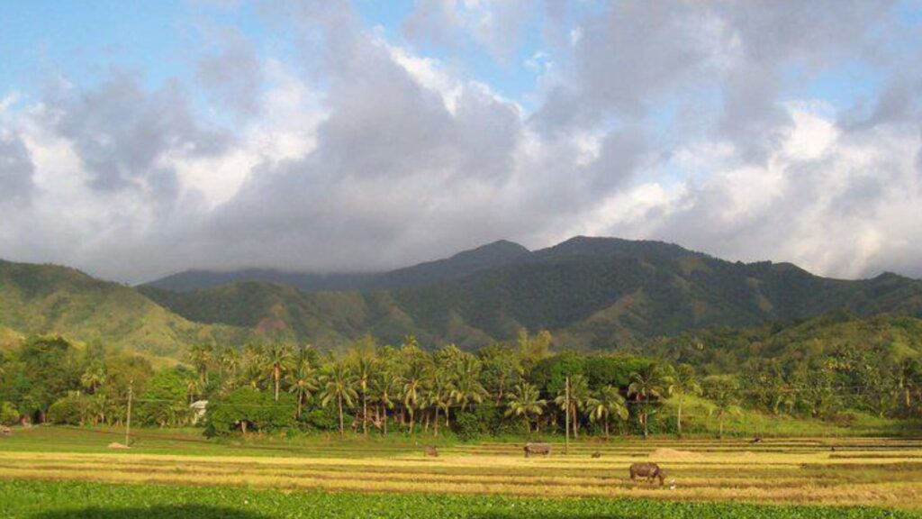
Mount Talinis (1903 MASL)
Known as the “Cuernos de Negros” or The Horns Of Negros, Mount Talinis in Negros Oriental is famous for its twin peaks, lake craters, and mystical view. Despite being the fifth-highest mountain in Visayas, it is one of the most popular hiking destinations due to its diverse ecosystems, which include sulfur vents, as well as enchanting lakes such as Lake Yagumyum and Lake Nailig. The summit offers a view of Negros and Siquijor Island. Unlike the other peaks, Talinis is much more accessible, making it great for intermediate hikers. It’s unpredictable weather, though, and steep sections still need proper preparations.
How To Get There?
Exact Location: Sitio Danao, Brgy. Bulanao, Valderrama, Antique, Philippines
- By Car: From Dumaguete City, drive northwest toward Valencia town for about 30 minutes. Take the road to Lake Balinsasayao and follow signs to the jump-off point in Apolong or Bediao. Use Waze or Google Maps and search for “Mount Talinis Trailhead” for precise directions. The last stretch may require a 4-wheel drive vehicle, depending on road conditions.
- By Commute: Start your journey from Dumaguete City, take a jeepney or van bound for Valencia. Inform the driver to drop you off at the junction to Lake Balinsasayao. From there, hire a habal-habal (motorcycle taxi) to the trailhead in either Apolong or Bediao. Guides are recommended and can be arranged at the jump-off point.
From the Slopes of Kanlaon to the height of Madjaas, the Visayas offer high mountains that offer unforgettable adventures for those who want to take on a challenge. Each peak represents different qualities, stories, and beauty, making them a must-visit destination.
Comments are closed.